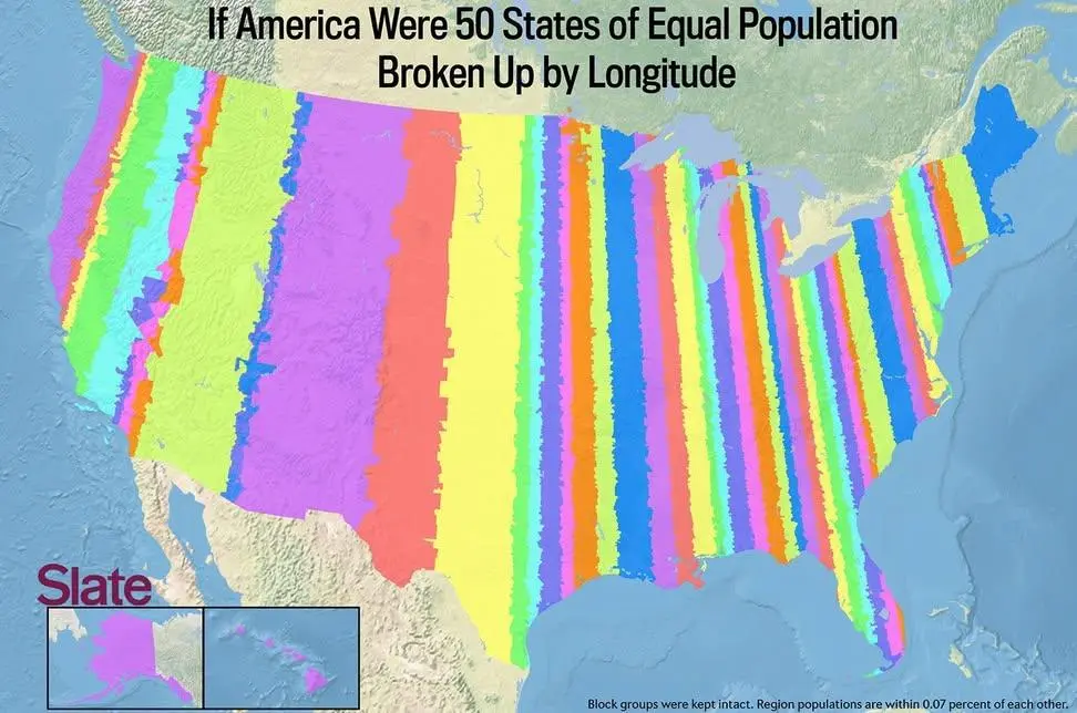
Map of the US if 50 states were formed by equal population and split by parallel longitude.
(sopuli.xyz)
We need some state names for these. A few -stans would be appropriate as well.
We need some state names for these. A few -stans would be appropriate as well.
It may be zip code boundaries, given how narrow the NYC strip is. Some of the excessive jankiness in what was Nevada would be because no one lives on a lot of the federally-owned land reserves out there, so they don’t get their own post office, and the catchment area of some zip codes gets huge with weird boundaries.