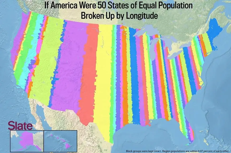
Map of the US if 50 states were formed by equal population and split by parallel longitude.
(sopuli.xyz)
We need some state names for these. A few -stans would be appropriate as well.
We need some state names for these. A few -stans would be appropriate as well.
They are talking about how some states are bigger than others while having a smaller population. The width, in this case, means just the area of land which a state would have to be to have a population count equal to all other states.
here's the article