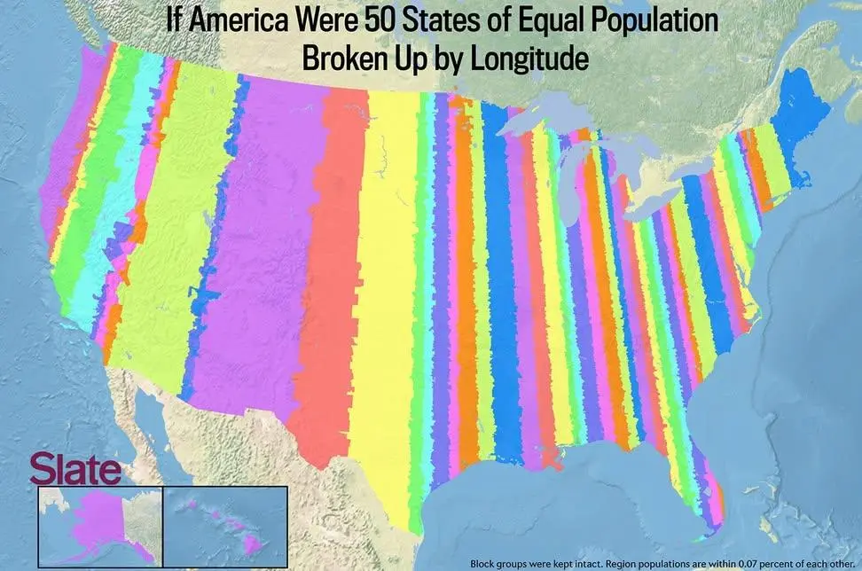
Map of the US if 50 states were formed by equal population and split by parallel longitude.
(sopuli.xyz)
We need some state names for these. A few -stans would be appropriate as well.
We need some state names for these. A few -stans would be appropriate as well.
"Equal population" means each stripe has the same number of residents in it. Wider areas with the same total number of people indicate a lower population density. Closely spaced lines show there are a high population density.